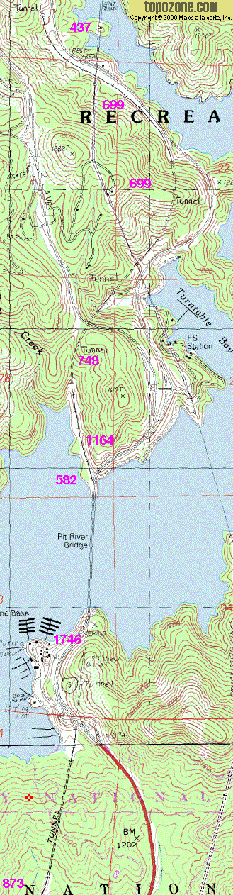
This map shows 5 miles out of 30 in this speed zone. Flooding Shasta Lake has made this area difficult terrain, needing lots
of tunnels and bridges.
In the map, curve radius is given in meters.
The underlying map is found on ![]() .
.
© Maps a la carte, Inc, used with permission.
The following link shows a map of Shasta Dam,
that still includes the old railroad track in the Sacramento River Valley. It is a recreational trail today. There is
also an overview over the whole speed zone and all the arms of Shasta Lake. Navigation, magnification and
resizing needs Javascript on that site.