Speed-Zone 7:
Azalea to Black Butte
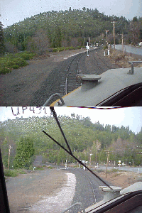
Mt. Shasta is the reason for a faster 1880s railroad alignment in this section. The debris of the volcano has helped to level out the landscape around that mountain. A remaining deep canyon was filled by Southern Pacific in the 1920s, replacement for a huge wooden trestle. This is the Azalea siding today.
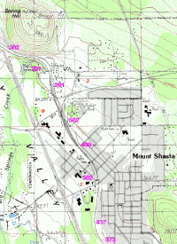
Black Butte is the point, where the Shasta Route splits into the old Siskiyou line of the 1880s, and the Natron Cutoff of the 1920s. It's no station and no settlement, just a shunting yard and the wye towards the Siskiyou.
With a radius of 955 feet, these two curves are the tightest between Azalea and Black Butte.
Curvature of 1910 feet and 1432 feet radius sets most of the speed restrictions in this section, meaning 70 mph and 60 mph for the example trains. The tightest curves are found in and around the small town Mt. Shasta. The worst have a radius of 955 feet, forcing a restriction of 49 mph for this one s-curve.