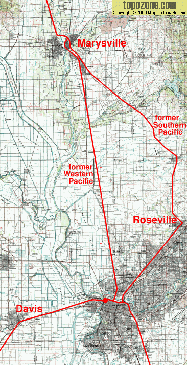
The former Western Pacific is the shorter and straighter route. The passenger potential at Roseville depends on the quality of public transport, which isn't high at the moment.
The underlying map is found on ![]() .
.
© Maps a la carte, Inc, used with permission.
Two start options for the TopoZone server are given here:
A big overview over the Sacramento agglomeration or a
small 1:50000 view on Marysville and Binney Junction. Navigation, magnification and
resizing needs Javascript on that site.